Water management under climate change is a crucial challenge in Catalonia and globally. Predicting water quality and quantity in basins, reservoirs, lakes and coastal areas is essential to assess the health of natural and social systems that depend on water. This project proposes the development of digital twins of these ecosystems, integrating them into short- and long-term forecasting services using innovative technologies such as artificial intelligence, high-performance computing and remote sensing. This will improve the capacity of water cycle managers to provide services that understand and respond to climate change impacts on aquatic ecosystems.
Water management in Catalonia faces numerous challenges such as scarcity, pollution, climate change and biodiversity loss. The increasing availability of new climate products and advances in aquatic ecosystem modelling make it possible to produce reliable forecasts of lake and coastal dynamics at regional and global scales. These technologies, together with the use of remote sensing and artificial intelligence, allow us to anticipate events such as floods and droughts, and to project future climate changes, facilitating more sustainable water resource management.
Main Objective: To co-develop digital twins for predicting water quantity and quality in the Ter and Tordera basins, including catchments, reservoirs and coastal areas, contributing to efficient water resource management, protecting ecosystems and maximising water security in a climate change context.
Secondary Objectives:
● To use digital twins as pilots for the creation of a climate service for forecasting hydrological variables.
● To strengthen the capacity for assimilating observational data into digital twins through the integration of digital technologies.
● To adapt the digital twins in collaboration with the relevant stakeholders to ensure appropriate adaptation to climate change, drought and other extreme climate events.
Project Methodology:
- Development of workflows for predicting key variables in each system, including data assimilation from multiple sources.
- Co-creation with users and stakeholders to tailor digital twin functionalities to the specific needs of each pilot.
- Use of high-performance computing for the deployment of digital twins.
- Integration of remote sensing into digital twins to improve primary production estimation algorithms and spatial analysis.
- Development of artificial intelligence models to predict water quality variables.
Preliminary Results
You can use a development version of our digital twins through the following links:
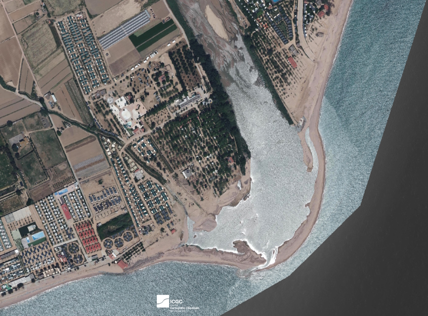
- Viewer for saltwater intrusion data at the mouths of the Ter and Tordera rivers: https://nereidaca.github.io/saltwater_intrusion_data/
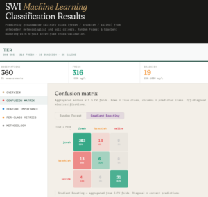
- Saltwater intrusion modelling at the mouths of the Ter and Tordera rivers: https://nereidaca.github.io/saltwater_ML/
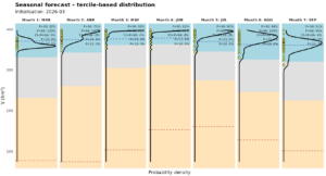
- Seasonal forecast (next 7 months) of river flows in the Ter and Tordera and water volume in the Sau and Susqueda reservoirs: https://nereidaca.github.io/seasonal_hydro/
- Forecast of physico-chemical parameters and HAB index in the coastal water bodies off the Ter and Tordera rivers (coming soon).
The Catalan Water Agency (ACA) contributes to the monitoring of NEREIDA, the provision of data, and the co-creation meetings for the digital twins.
Principal Investigators: Rafael Marcé and Jordi Pagès. Other researchers involved: Daniel Mercado
Project funded by the Catalan Water Agency (ACA).